
Mainland England has endured heatwave after heatwave this Summer. Flowers have lost their bloom, grass is short and shrivelled, leaves drooping and lifeless. Time to escape to a wetter cooler place but not a million miles away.
The Isle of Man is one of the UK’s Crown Dependencies, like the Channel Islands of Guernsey and Jersey, but much less frequented and rather under the radar. Pre 1960s it was a prime holiday destination for, especially, northern England residents, who would fill up the ferries of the Isle of Man Steam Packet Company for the few hours voyage to Douglas. Once landed, they stayed in the charming pastel coloured boarding houses along the promenade and enjoyed the pleasures of the beaches, horse rides, and, of course the island’s TT races, immortalised by George Formby and his ukelele. But come the package holiday boom they all went to Spain instead, where the climate was less fickle.
The Isle of Man is a UNESCO Biosphere. In fact its entire territory was the first in the world to be designated as such ‒ in 2016, in recognition of its bio diversity, culture and heritage, and sustainable practices. The island features heather covered moorlands, valleys, wetlands and a splendid coastline, everything in fact that one could wish for on a small island, a microcosm of the UK mainland. But delightfully tranquil in comparison. No motorways. Just one short stretch of dual carriageway, otherwise sublime country roads. A number of heritage railways still transport tourists and locals alike at a gentle pace to the island’s hot spots. It has its own language: Manx.
My daughter lives on the island. A good excuse then for a not so quick flit across the Irish Sea. Across this sea, the strongish westerly winds blew the ancient Vikings with their longboats. They raided and stayed, mixing with the local Manxmen.
Peel
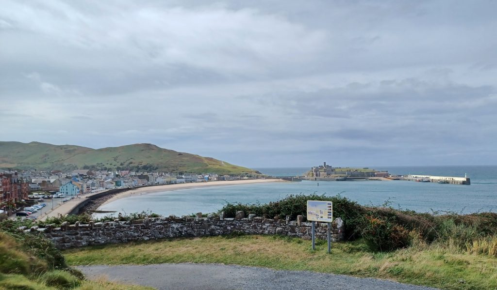
Head downwards from my daughter’s house to the cliffs above Peel Bay. There is a glorious vista from these cliffs over Peel’s long yellow crescent beach, Peel Hill and St Patrick’s Isle. Upon the latter little islet stand the ruins of Peel Castle, built by the Viking, King Magnus Barefoot. Below Peel Hill is the inner harbour, filled with fishing boats and yachts, and now shielded by a lock gate. And to the right, a long quay juts out protecting the harbour entrance. A lighthouse perches on the end. Some years ago, while on a voyage south from Iceland we moored our trawler alongside this quay. There was no lock to the inner harbour then and the Viking replica longboats lay keeled over in the soft mud.
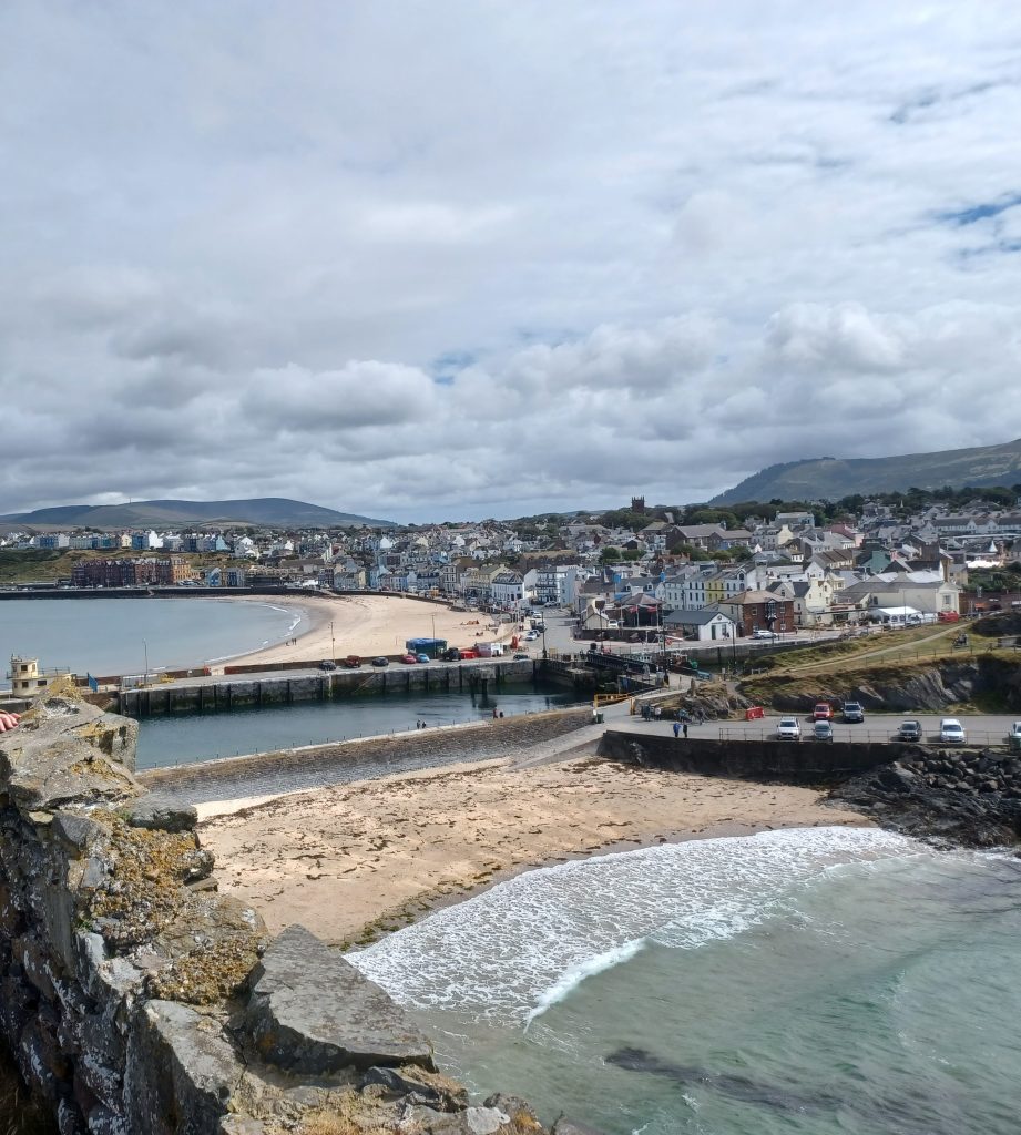
We wander across the cliff tops to peer down upon a Victorian built swimming pool amongst the rocks at the base of the cliffs, once an alluring bathing place. Visitors, I gather, could come here by boat or descend the steepish steps. Must have been fun. Some rather fine bungalows adorn the edge of the cliffs here. A prime location.
Descend to the promenade. Folks are swimming off the beach and a few gulls are fooling about in the weed covered rocks. Behind the beach is a café, a kiosk actually, with a couple of ladies serving the many punters sitting at the outside tables. Settle down to join them and relax a while before continuing our stroll. We pass the lifeboat station, first established in 1828, then head along the quay to the lighthouse. Climb the steps to the top of the wall and walk back.
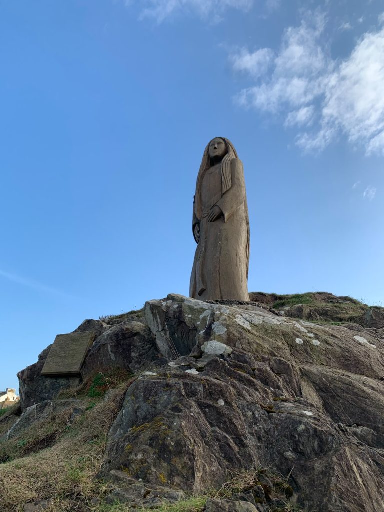
Next to the lifeboat station behind the causeway wall, which connects St Patrick’s Isle to Peel Hill, is a beach, named Fenella Beach. Said beach was formed when the causeway was built in the 1730s. From a small rocky outcrop a statue, carved in ash, of Fenella, a character in Sir Walter Scott’s 1823 novel, ‘Peveril of the Peak’, overlooks the beach. Tourists were attracted to the town and this area around the castle due to the novel, apparently, and the present statue continues to intrigue visitors. Sculpted by artist Nick Barlow, Fenella was installed in 2011.
Shells used to be regularly emptied onto Fenella beach from a seafood booth the other side of the wall at one time but EU regulations put a stop to it. Still plenty of shells on the beach though, scattered in glittering spots. There is a fine view of Peel Castle from here and we spy walkers rambling round its outside walls as we gaze towards it.
Peel Castle
Apprised by our phones that rain is in the forecast, we dither a while before electing to visit the castle ruins. Not a bad day at all as far as I can see. Warm, though a bit cloudy. Rain has not yet decided whether or not to fall, so we venture up into the castle gatehouse, purchase a weekly pass, which encompasses visits to other heritage sites (good deal), grab an audio guide and enter.
The islet was first a Christian site, we learn, having been inhabited by Irish missionaries. There seems to be some debate as to whether said missionaries were led by St German or St Patrick, although legend has it that St Patrick brought them here in the mid fifth century, hence the name. In fact there are several churches and holy wells named after St Patrick on the Isle of Man. Anyway, the islet is a heavenly sort of place and appropriately isolated. It was fortified by the Norwegians in the 11th century under King Magnus Barefoot, whose original wooden fort was excavated by archaeologists in the early 1980s. After King Magnus’s time, the castle hosted a 13th century Christian cathedral, and later the Lords of Mann built apartments adjacent to it after the Isle of Man passed to the English in the 14th century.
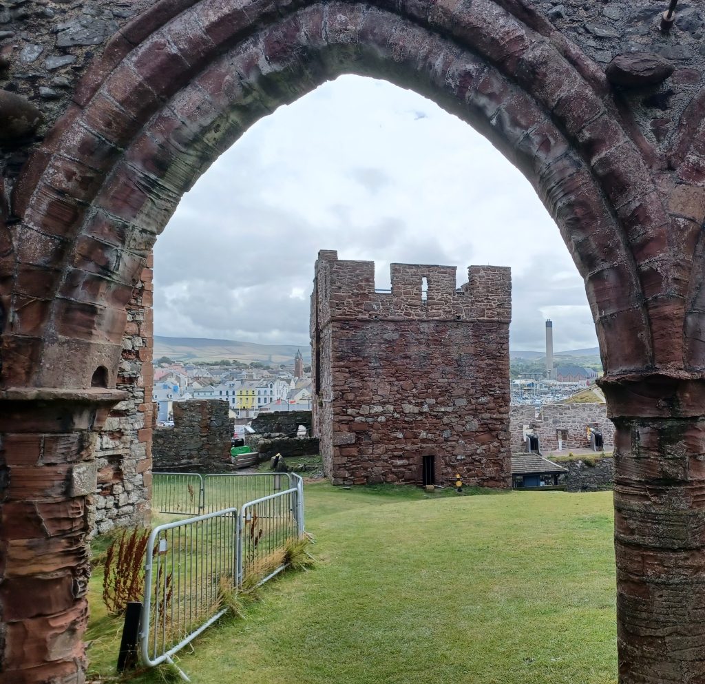
We trample upwards over the soft grass. Seven hundred metres of curtain walls surround this two hectare space, which contains diverse ruins, such as the cathedral, chapels and cemetery, as well as fortified towers with arrow slits. Built mostly of the local sandstone. Great view as we wander up the verdant slope and look down upon the remains of the cathedral, the gatehouse and Peel Bay.
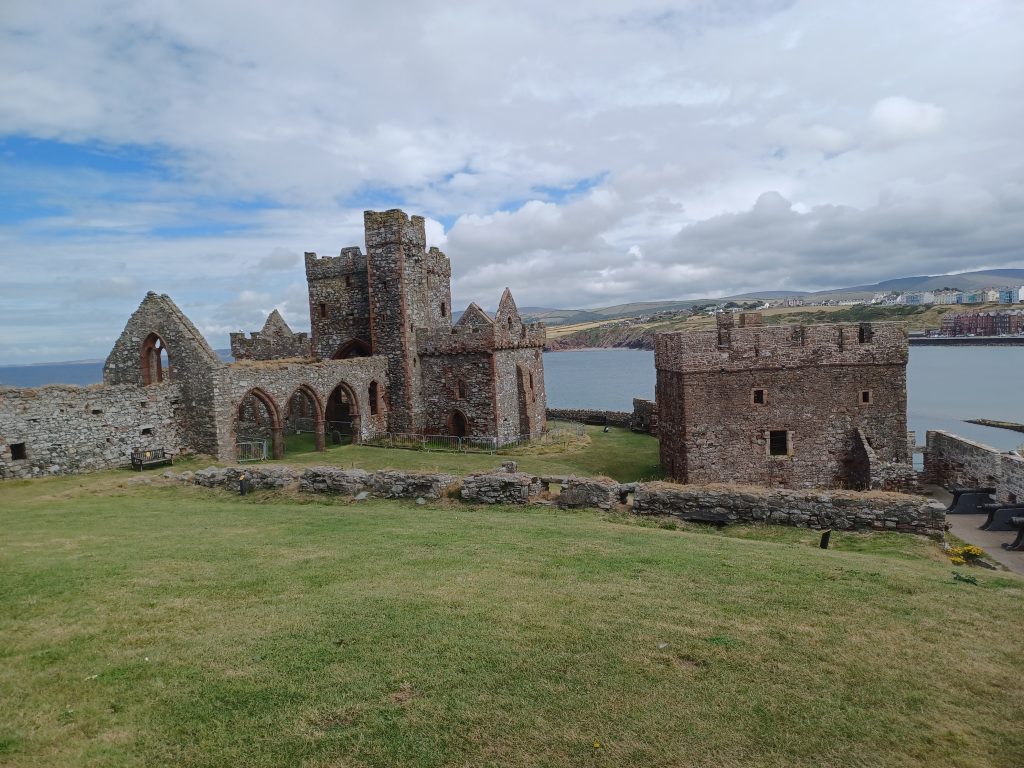
Walk around the edge of the walls noting the old toilets strategically placed, the turrets and passages. We are hoping, of course, to spot the Moddey Dhoo, the legendary Black dog that haunts the place, but don’t. Said dog also features, along with Fenella, in Scott’s ‘Peveril of the Peak’ novel.
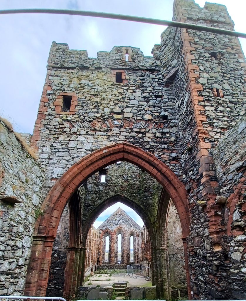
Then inspect the cathedral, dedicated to St German. Not in a bad state of repair considering its age, though lacking a roof. In the 1770s the chancel was the only part of the building with a roof intact. There was a plan to restore it all in 1877, apparently, but it came to nought. The trouble was, there was already a St Peter’s church in town, within which many folks were worshipping instead, because the cathedral was so difficult to reach. One could only cross over to the isle at low tide on foot or horseback, as the causeway connecting it with Peel Hill had not yet been built. Anyway, the cathedral was abandoned in the late 17th century and used for burials. We peruse some of the inscriptions. There was also a crypt underneath, which, at one time, hosted prisoners, incarcerated by the clergy for breaking the Sabbath.
We come across what was once a Christian cemetery, where archaeologists found some pagan Viking graves, including an elaborate burial of a ‘pagan lady,’ dated to 950 AD. With her was a necklace made of 73 glass, jet and amber beads, an ammonite fossil, and a hoard of silver coins, among other things.
The Manx flag flies on a mound within the grounds. There are splendid views from here across to Scotland and the Lake District to the north, and in the nearer distance, the curving golden sands of Peel beach, the town, and tower of the current Cathedral of St Germans. Further along, on the crest of the isle, is the best preserved ruin, the 11th century Irish style round tower, once part of the Celtic monastery, and used as a belfry. Battlements were a later addition to the top and it was used as a look out point. Remnants of St Patrick’s Church are adjacent.
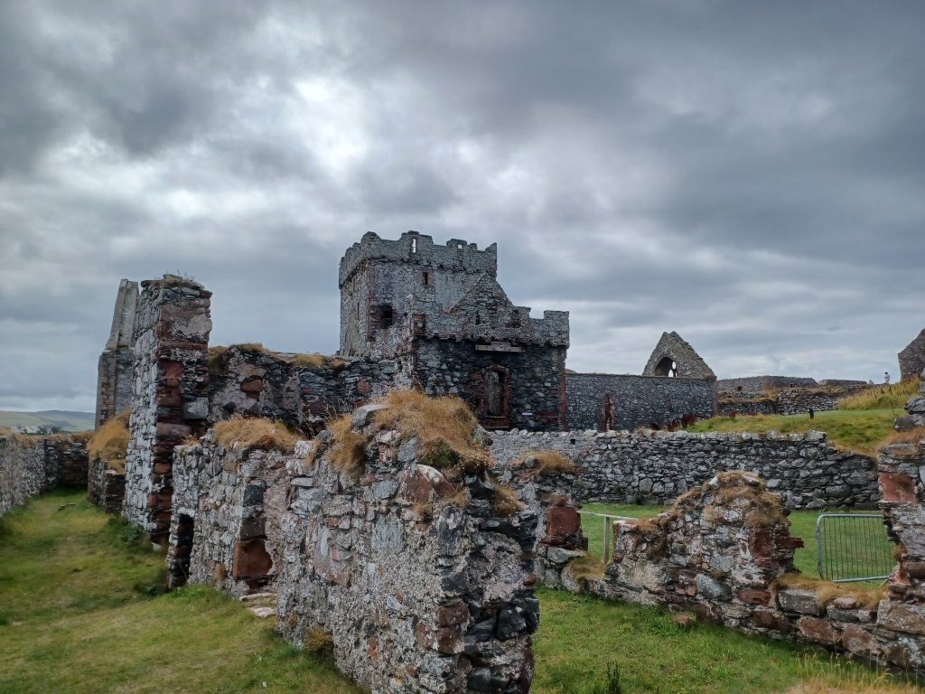
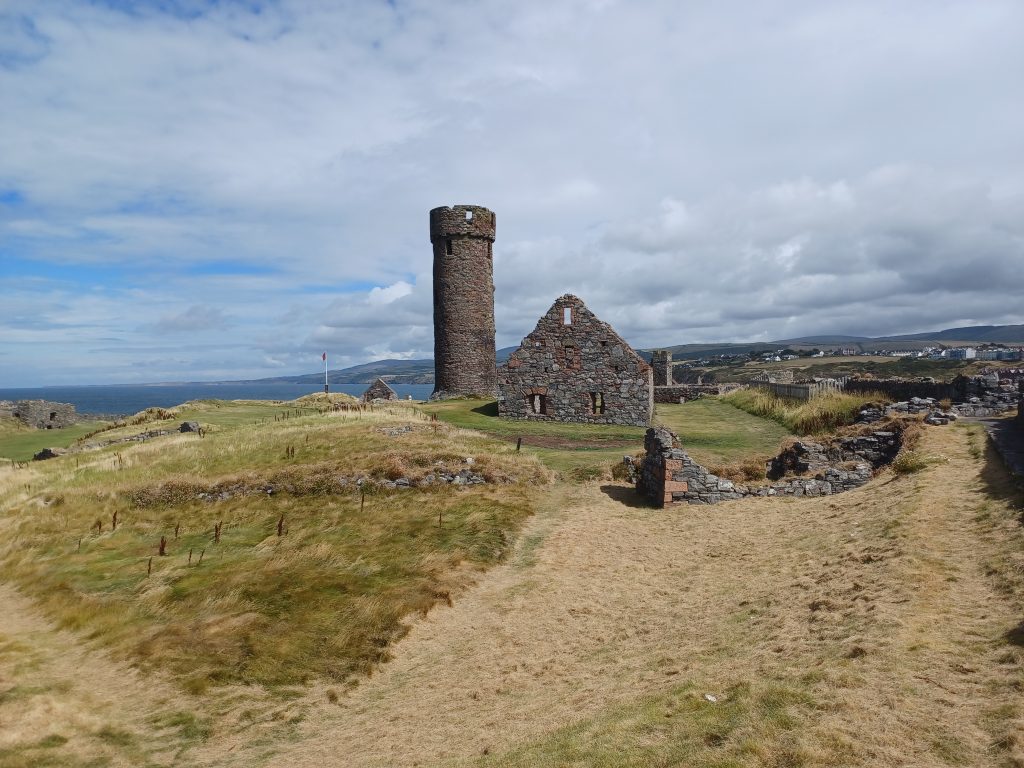
Head back towards the exit now, pausing to view the town and Fenella beach from the walls, and the row of 16th century cannon, before advancing downhill through the gatehouse.
Lunch is on the agenda. Daughter can be relied upon to know where the best and closest eateries are to be found. Left turn to the Breakwater Kiosk, affectionately known as ‘Breaky’ by the locals. Indulge. A couple of motor-bikers are here too chatting away in German and stuffing themselves with sausages. Thence, pass Fenella beach, cross over the swing bridge over the lock and proceed along the waterfront to the museum, the House of Manannan, named after the mythological sea god. Fascinating museum. Have visited a few times. It is full of info on Viking and Celtic history, including reconstructions of houses and a Viking longboat. No time today. We continue up the hill behind the harbour.
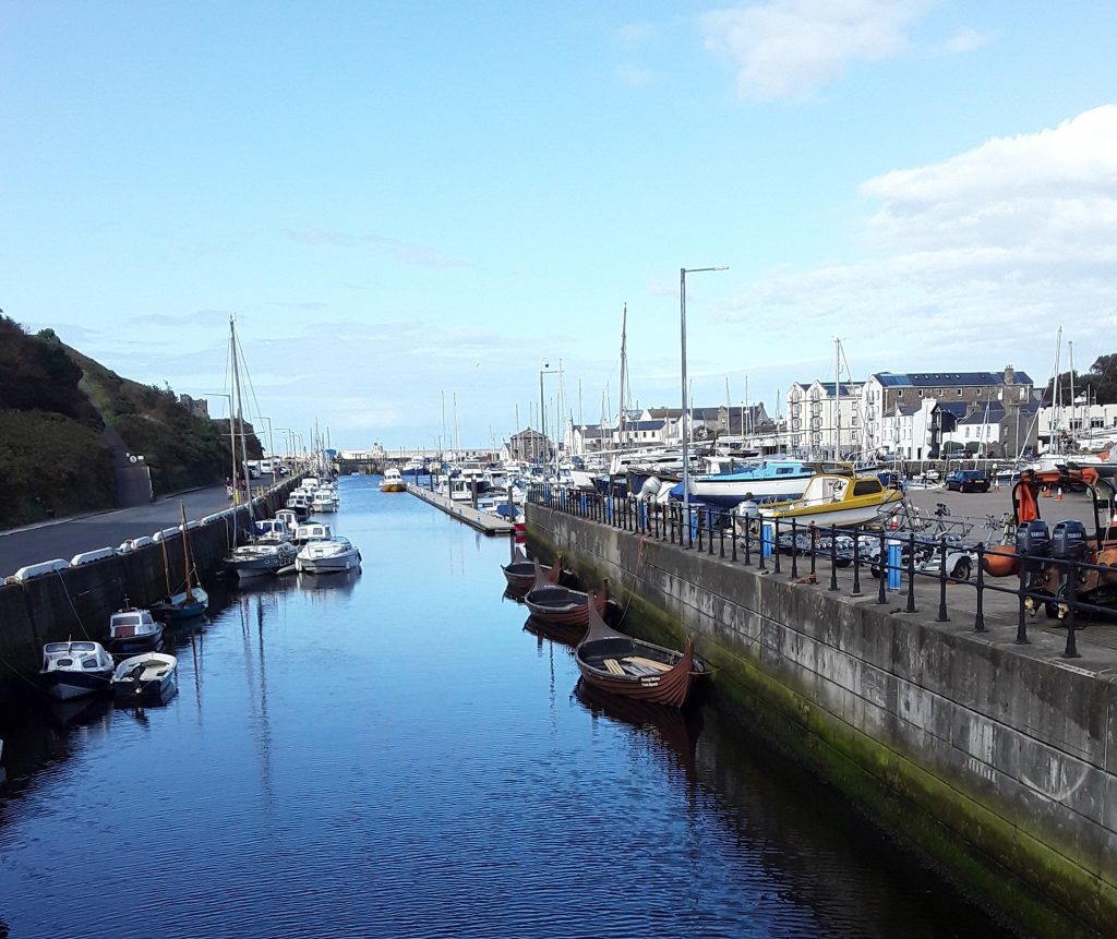
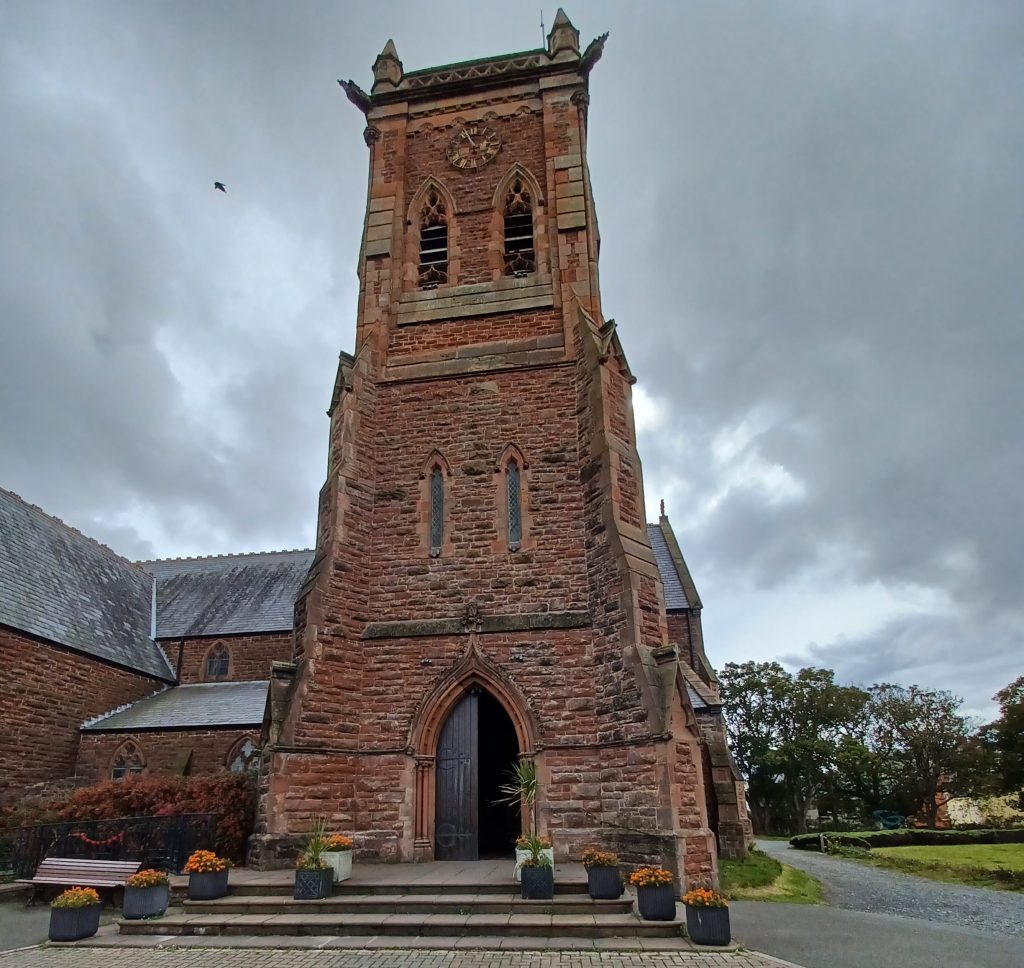
We pass the tower of St Peter’s, the only part of this former church still standing. St Peter’s had been the parish church for some while and, especially, when the Cathedral of St German on St Patrick’s Isle was abandoned. But it was considered too small for the flock. So another, new church, was built in 1884. This was dedicated to St German. It was upgraded to a Cathedral in 1980 and caters for the Sodor and Man diocese. I rang the bells there once.
TT Races and Manx Grand Prix
The Manx Grand Prix is taking place on the Isle of Man at the moment. I gather that the Grand Prix caters for amateur racers, while the TT races, held earlier in the year, are for more experienced riders. As George Formby put it in his hilarious lyrics, beginning thus:
“If there’s one thing that I like, it’s riding around on a motor-bike…” and bade everyone come and watch his derring-do:
‘Come along and see me riding in the TT races
Easier than hop scotch, beating all the top notch aces…’
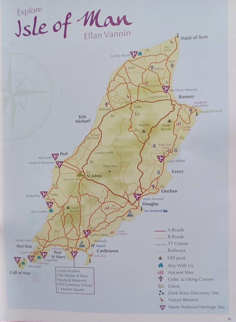
On a more sober note, two bikers were killed in the TT races this year in the interests of this extreme sport. Anyway, the current Grand Prix lasts for nine days and roads are closed at various times while motorbikes race round the island. Along the route of the course, soft padding has been applied to trees and protruding walls. And the pavements have black and white painted kerbs, which indicate the race course route (marked with dotted lines on the map).
Point of Ayre
Our plan today is to head to the north of the island to explore the Point of Ayre or, more specifically, the nature reserve here. And we have timed our trip here in order to drive the direct route northwards before the road closures. So right now we are travelling along the race course at a sedate speed.
Reach the Point of Ayre, which has fairly recently been designated a National Wildlife Reserve. Hides have been built and small pools dug out and planted with reeds and lilies. We wander the pathway around the reserve, observing snipe in the shallows, loads of cormorants airing their wings, tufted duck, lapwing, gadwall. And swallows flitting about. About thirty species spotted today. Dragonflies are buzzing around too and butterflies flutter on flowers. Pleasant amble on this northernmost point of Man.
We drive back via Bride and visit its tearooms for lunch. Thence, a quick nip into Bride Church across the road. Nice little church with circular roof tiles on a turret. Dedicated to St Bridget. Lot of churches on the Isle of Man. John Wesley preached here back in the day. I am told that an annual Parish walk takes place whereby enthusiastic walkers hoof it to every church on the island. That would be an interesting experience, I muse. Head back on rolling roads via Ramsey to Peel.
Laxey
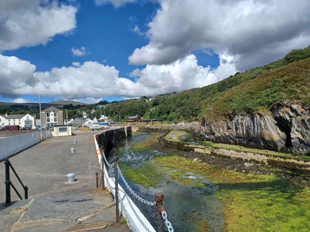
The huge water wheel at Laxey beckons today. I remember seeing it in the distance on a previous visit or two. Anyway it was closed for some while for conservation. So now is our chance to inspect it more closely. We set off again before the roads close for the races and make the short journey to Laxey’s harbour, our first stop. The harbour was built to load and ship the ores from the Laxey mines close by. It is a pretty harbour. The tide is out. Snaefell, the island’s mountain at 2036 feet (has to be over 2000 feet high to be designated a mountain, I understand) rises in the distance with its two masts perched atop.
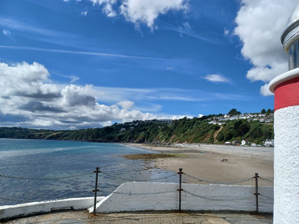
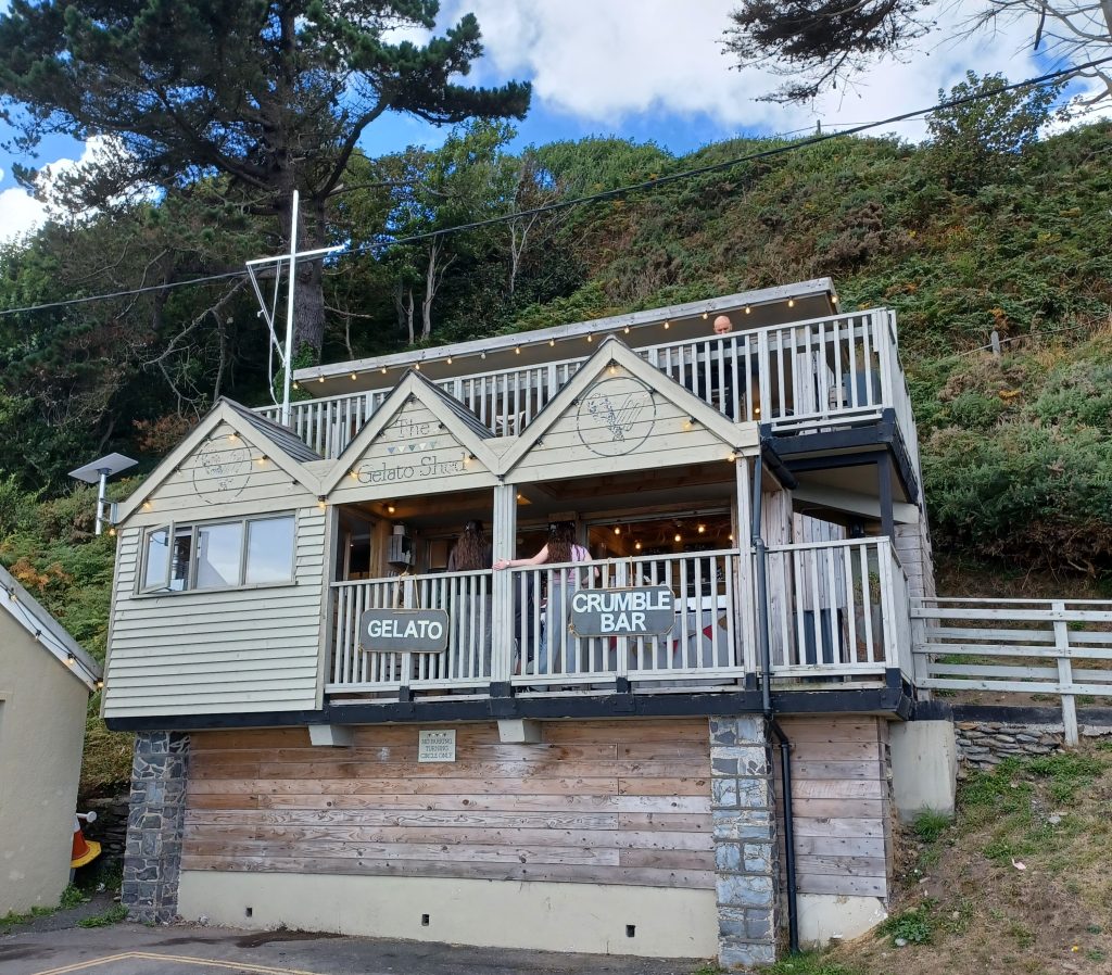
There is a lovely beach here, wide and sandy. Calm waters. Not very hot today – about 16 degrees C – but nonetheless some robust Manxmen are swimming whilst others are relaxing in the beach front cafés. Do likewise. One of the refreshment establishments is the wonderfully named ‘Gelato’ and ‘Crumble Bar’.
Laxey Water Wheel
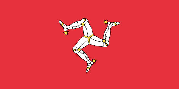
Once fed and watered we head off to view the water wheel, the oldest in existence. Still used. We are greeted by a large cast iron Triskelion on the front of the structure. This is the three legged symbol on the Manx flag, the motto of which is ‘quoqumque jeceris stabit’, whithersoever you throw it, it shall stand. ‘Triskeles’ actually comes from the Greek for’ three legs’ but the symbol itself predates the Greeks, as well as the Celts, going back to the neolithic times. As well as adorning the Manx flag, the Triskelion also features on the flag of Sicily. Parked in front of the fresh wooden gate is a motorbike, another symbol of the island.
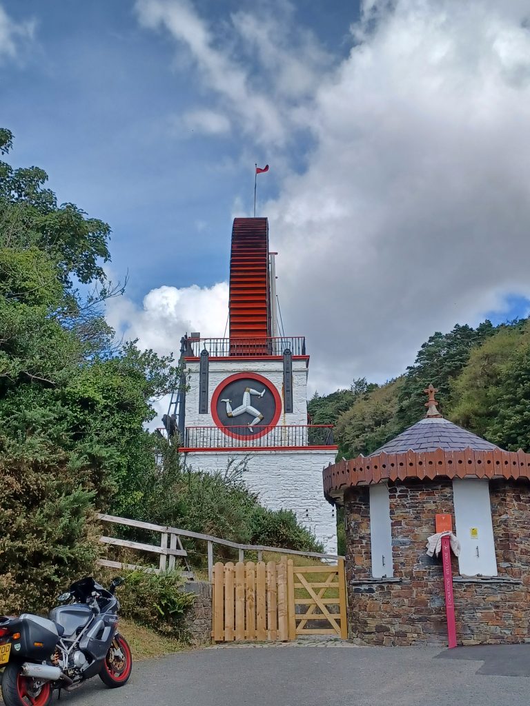
Enter through the shop and pass the ticket counter, flaunting our passes. Climb up a flight of steps to a platform on the wheel-case, then up a narrow spiral stairway around the tower to a viewpoint atop another platform above the wheel. At 72 feet six inches diameter, the wheel is impressive. We look down upon its bright red blades. And looking in the other direction one can peer along the long rod viaduct leading to the engine houses.
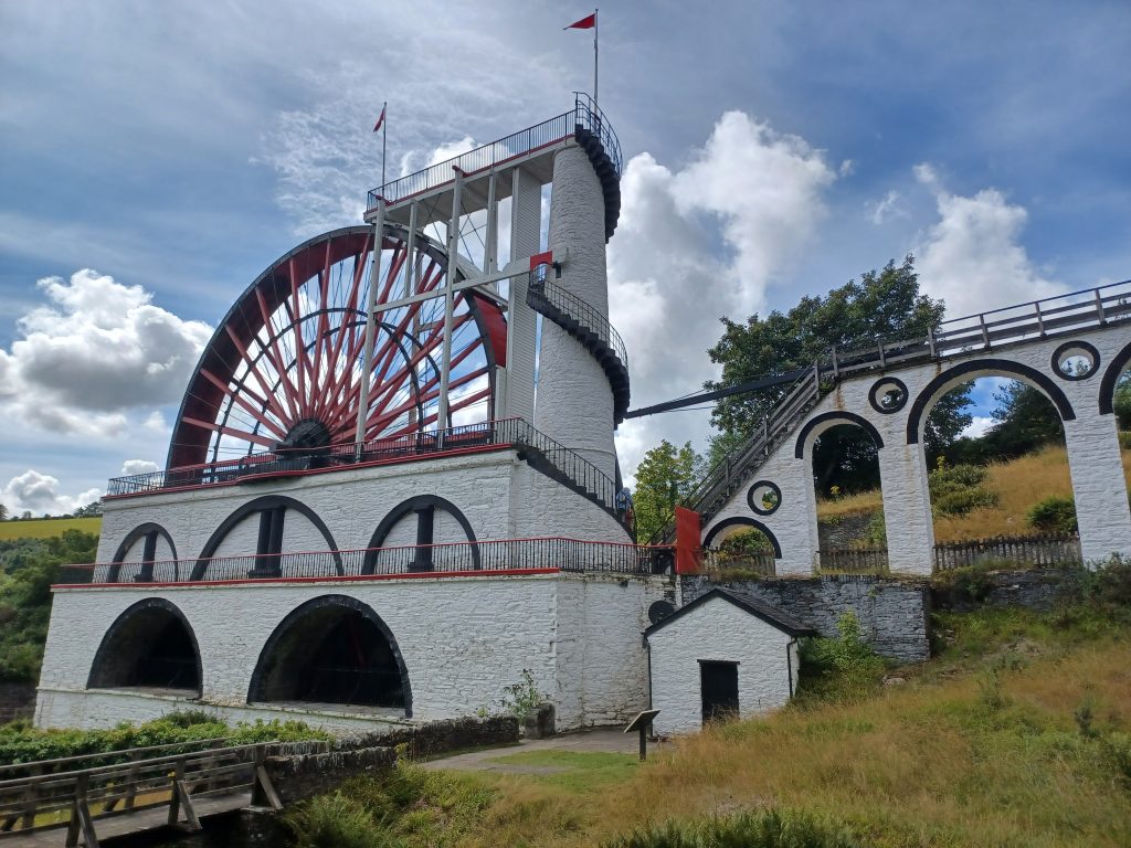
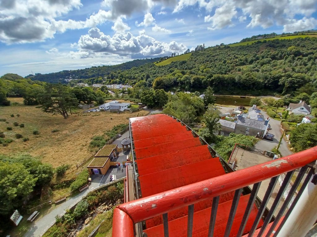
The water wheel was built to pump water out of the Great Laxey mine, which contained lead ore with a high silver content, as well as copper and zinc. In fact at its height the mine produced about half the UK’s output of zinc. There is no coal on the Isle of Man, so using steam power would have been expensive. Anyway, the mine was opened in 1854 and named ‘Lady Isabella’ after the Governor’s wife. An information board tells us that channels, or leats, led water from the surrounding hills to be collected in a cistern. This was then carried by a cast iron pipe to the stone tower base. ‘Water pressure built up and forced the water to rise inside the tower to the top and spill onto the wheel’, which pushed it (the wheel) in a backwards direction.
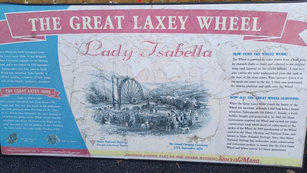
The Great Laxey Mine reached a depth of about 2200 feet but this increased the problem of flooding and the mine closed in 1929. After closure, it was purchased by a local builder but soon acquired by the Government and is now run by Manx National Heritage, as with Peel Castle and other heritage sites. The wheel was once more set in motion in 1970.
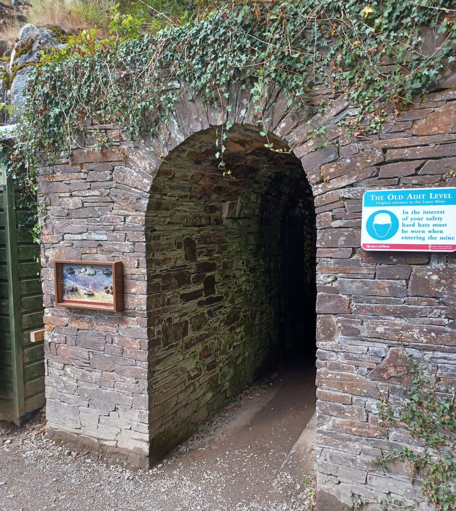
We wander up the valley following the viaduct to the old machine house, before returning to cross to the other side of the wheel. There we come to the tunnel where mining first started in 1790. Called the ‘Old Adit Level,’ ‘the only place where ore deposits reached the surface’. A few samples of the ore hang in a frame by the tunnel entrance. After being regaled with some history by an enthusiastic volunteer, we are invited to don helmets and, thence shuffle, heads bent, the few metres underground. Hit my head on the rocky ceiling. Solid helmet.
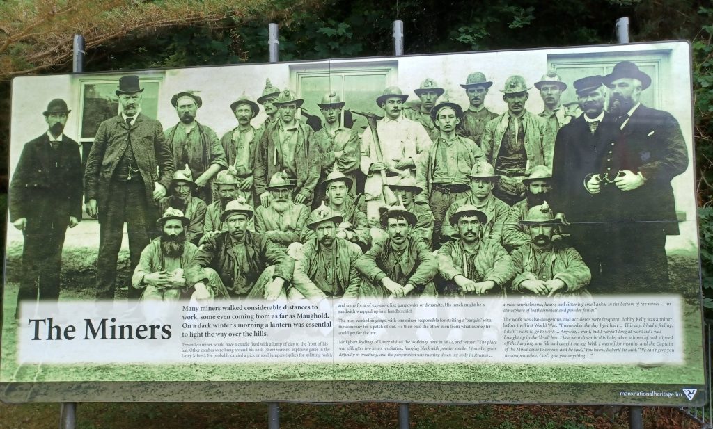
Hard life those miners and their families had. While the men descended to do the actual mining, the women and boys would work on the washing floors to crush and sort the ores. A significant industry built up round the mine, even a tourist industry, according to an info board, and cafés opened up to provide refreshments for them. The village became pretty much dependent on the mine and men travelled large distances to seek employment here.
Anyway, the Great Laxey Wheel reopened in 2022 after a major conservation project. A plaque commemorating this event hangs on the bright white wall, along with other plaques commemorating significant occasions. Looks splendid.
Douglas
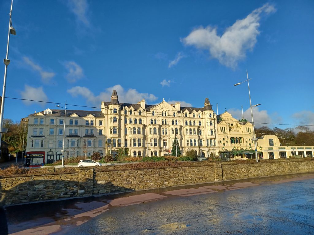
We drive home via a circuitous route, as the racecourse roads are now being raced over. There is an old heritage railway train alongside the road into Douglas, I note. Enter the city. Lots of traffic. Slow drive. Ergo, leisure to appreciate the buildings along the long curving promenade, which still boasts a horse drawn tram. Said tram was inaugurated in 1876. King Charles III, in his capacity as Lord of Mann, came here earlier this year – the 150th anniversary – and had a ride. A law has recently been passed by the Tynwald, the Manx government, to extend the horse drawn tram to the ferry point. I shall look forward to that then.
I like Douglas. The city is unspoilt and features not one ugly high rise. The Bee Gees brothers were born here, incidentally. Their music was popular during my youth in the 70s. They wrote the ‘Saturday Night Fever’ sound track, ‘Stayin’ Alive’, should you wish to know, and there is a sculpture of them on the prom.
Douglas during WWII
During WWII, Douglas housed ‘foreign aliens’ from Great Britain in its boarding houses/hotels along the prom, which were fenced off with barbed wire. There were several camps with various numbers of male internees, including Germans and Austrians in some, Italians in others.
There were even some Jews, who had fled Nazi Germany to find sanctuary in Britain, and some Japanese. One of the camps comprised the lovely Sefton Hotel ‒ I stayed there once ‒ along with other hotels. Most of these camps were fairly short-lived, housing internees from about the mid 1940s for a year or two. There were also women’s camps in other parts of the Isle of Man.
Douglas to Port Erin Steam Train
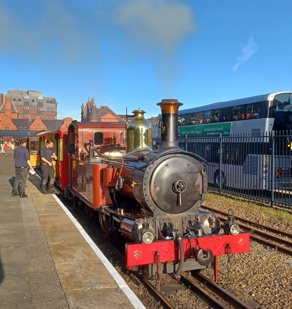
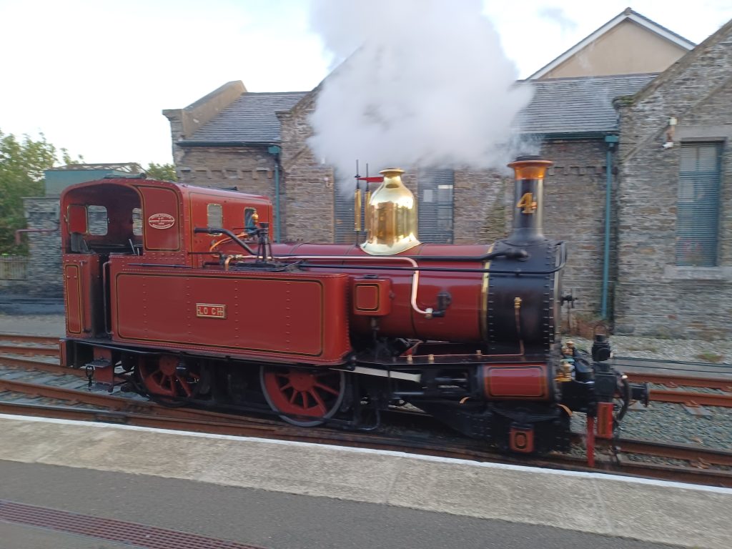
We have decided to take one of those Manx heritage railways today from Douglas to Port Erin. But we are taking an evening excursion, including supper in the dining car. A gorgeous old steam engine with funnel blowing steam all over the place shunts out of its siding to hook on to the railway carriages where we await on Douglas Station.
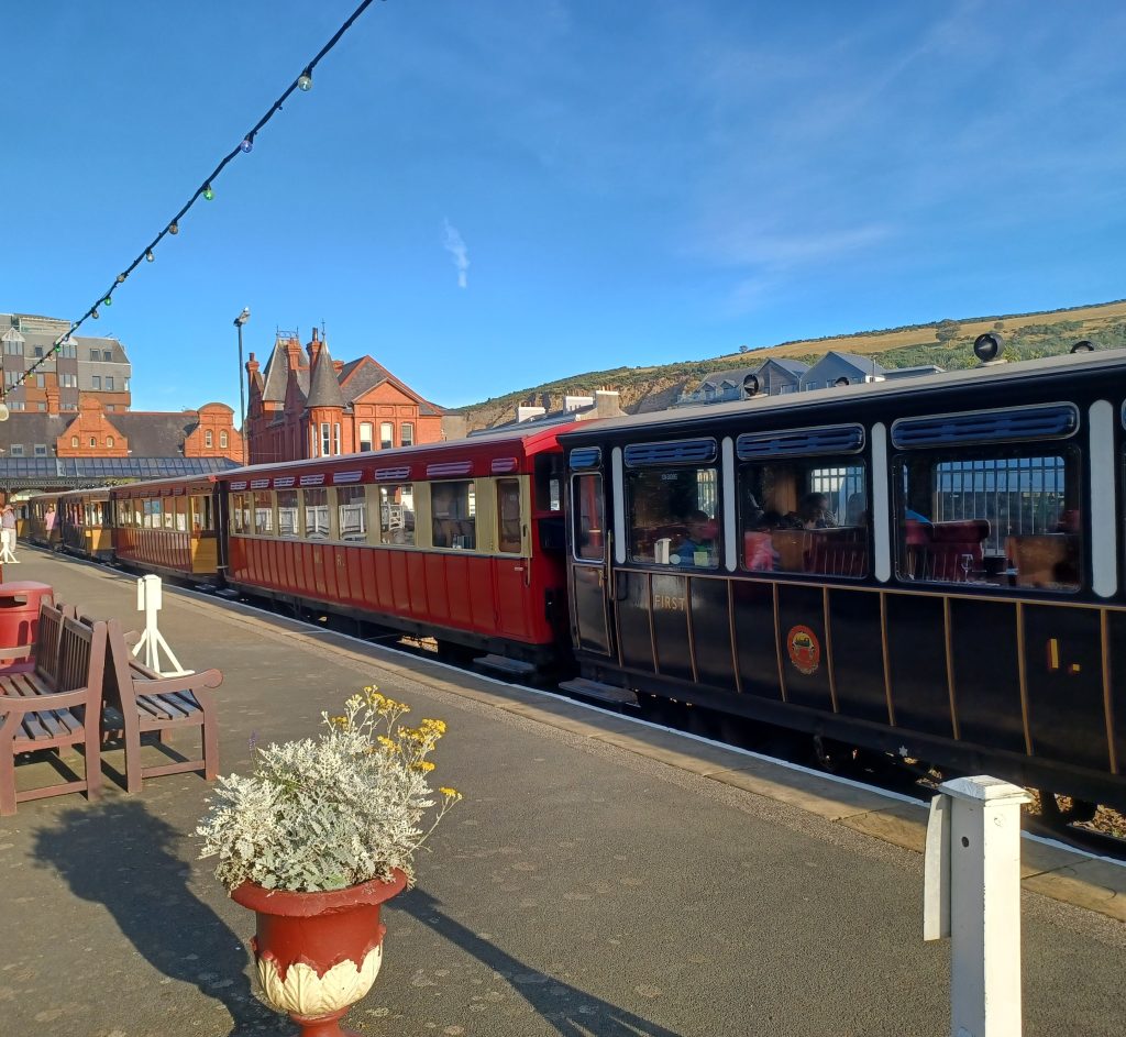
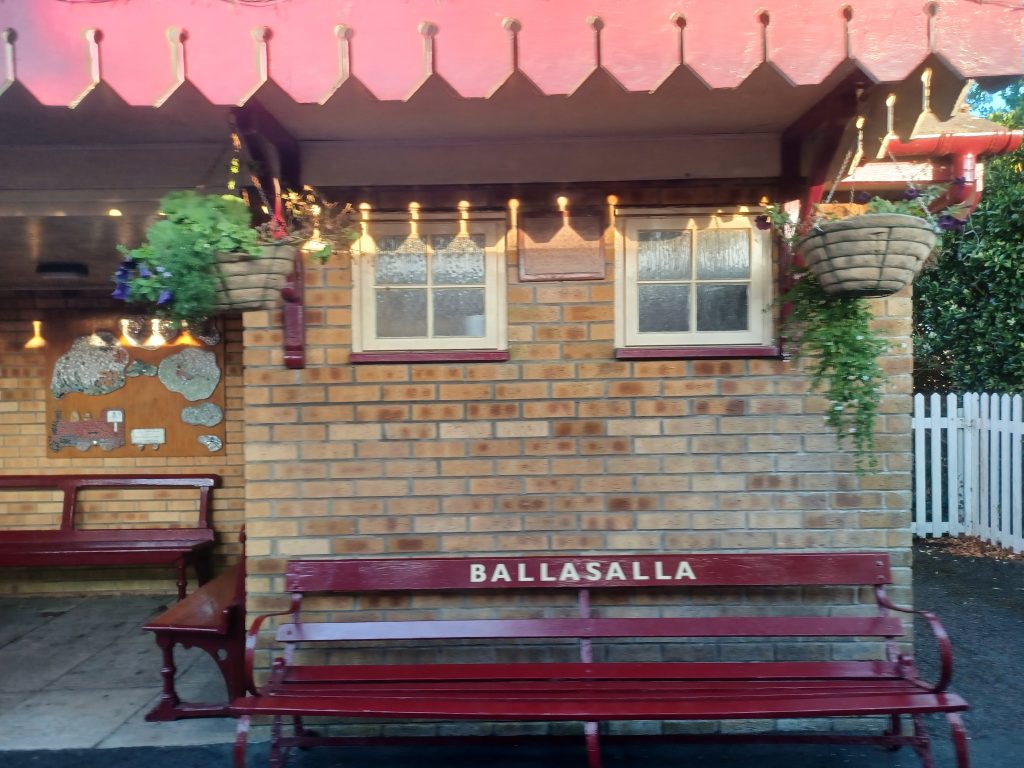
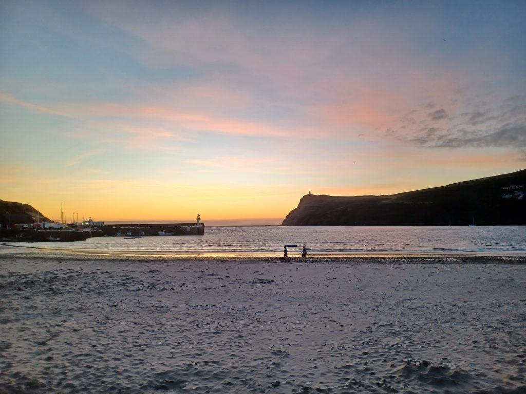
Various themed evening suppers are advertised aboard the train. Tonight it’s a Spanish evening. ¡Ole! Spanish flamenco music floods the wood panelled coaches. Not too loud though. Lounge back on the red upholstered seats. There follows a slow ride along the coast, past fields of sheep and bales of hay. Spanish food of course. First course, tortilla, is served. Pass little stations with flowers in baskets hanging from brick walls. Second course, pork with veggies, is served. Order a glass or two of vino. Arrive at Port Erin after an hour or so. Time here for a sunset leg stretch. The sun is setting behind Bradda headland with its folly atop, on the right and the lighthouse on the left. Manx flags fly in a stiff breeze all along the promenade. Hop back on the train. The engine shunts to the other side of the carriages. Dessert, apple tart, is served. And a final glass of port as we shuttle back to Douglas in the darkness.
Calf of Man
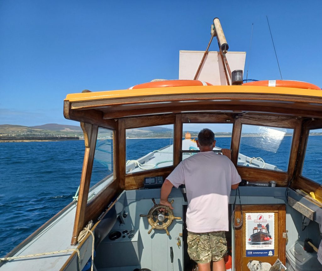
Today we are going on a boat trip on the southern point of the island. Oh good. I do like a boat trip. Our boat has a guide aboard, who acts as crew, as well as the skipper. Motor out of Port St Mary. The wind is blowing offshore from the north, so the sea here is sheltered by the island. Flat calm. Not far from the port, we pass the steep cliffs at Spanish Head. Slate used to be quarried from these cliffs. Fantastical rock formations, purplish in colour, and caves. A jellyfish lurks at a cave entrance.
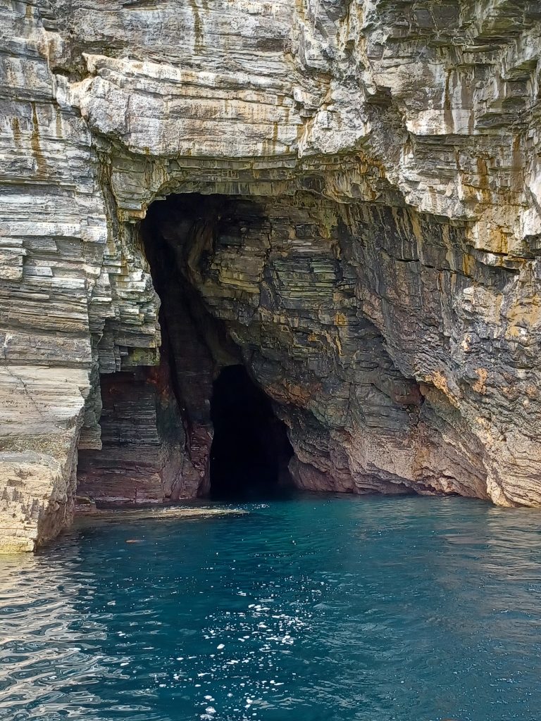
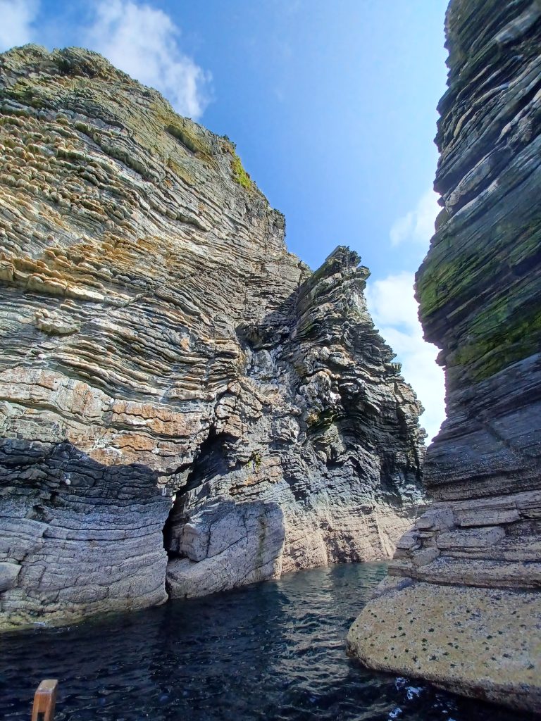
And guano covered cliffs from the thousands of seabirds that were roosting here back in June. All gone now, save a juvenile razorbill floating about. It looks lost. Scores of shags about though, their glossy black feathers glistening in the sunlight. Plenty of gulls, oyster catchers, and the odd bird of prey. A climber is tackling one of the cliffs here. Looks tricky. Not my kind of sport. I prefer a broad vista to a bare rockface.
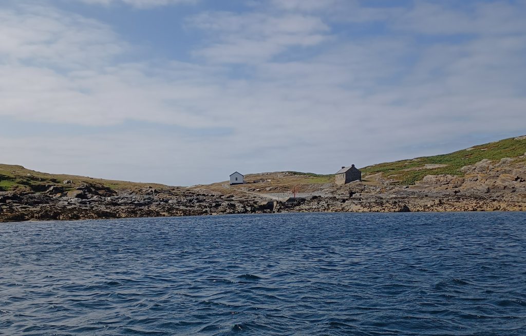
Soon approach the Calf of Man, the southernmost part of the Isle of Man. This is a separate islet of six hundred acres, which was once farmed, we are told, but it is no longer viable so to do. Also once mined for lead. It is now a nature reserve cared for by Manx National Heritage. Wardens reside on the island in the season. They live in the bird observatory. And up to eight visitors are also able to stay. Manx shearwaters breed here, as well as shags, kittiwakes and other species. Scores of seals are basking on the rocks around the island and a dolphin approaches and hops around the bow for a bit.
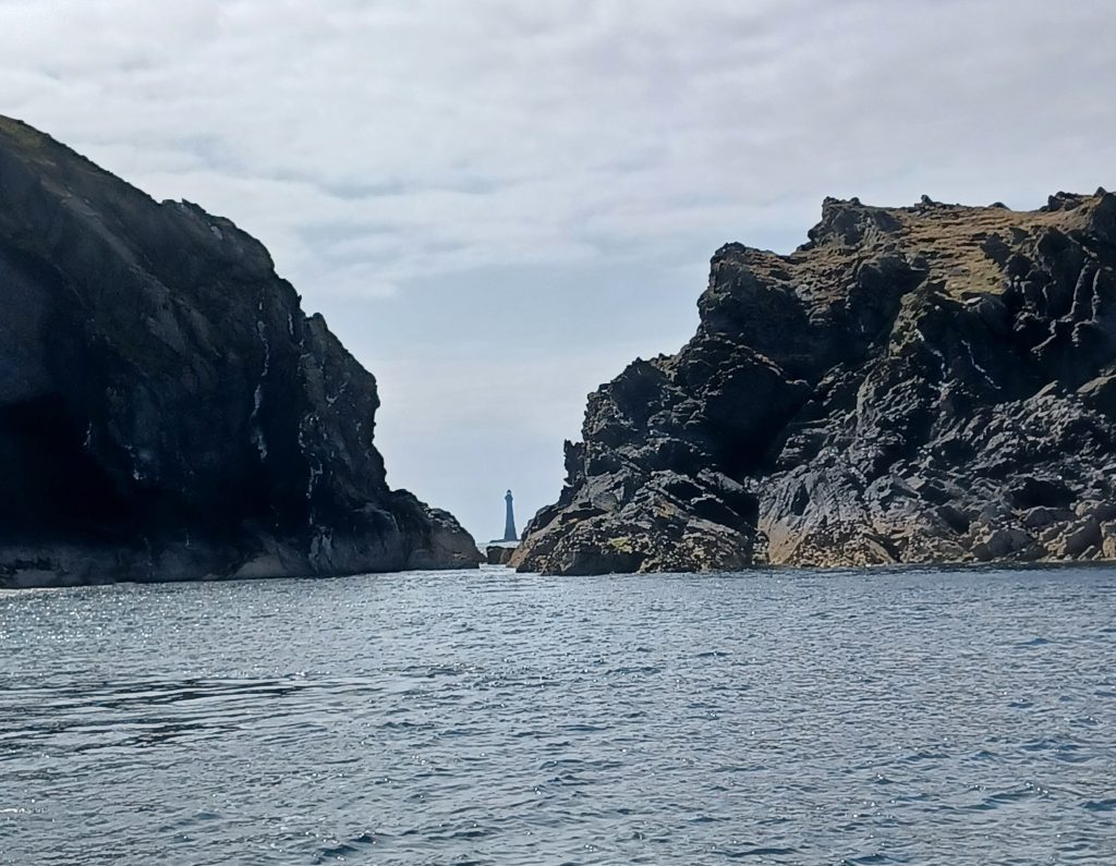
Two lighthouses built on the island in 1818 form a transit when aligned with each other. Designed by the renowned engineer, Robert Stephenson, to help prevent ships from being wrecked on Chicken Rock, a couple of kilometres offshore. These two Stephenson lighthouses were replaced by another lighthouse at the end of the 18th century on Chicken Rock itself. Good view of this lighthouse through a narrow gap between ‘Drinking Dragon Rock’ and the Calf.
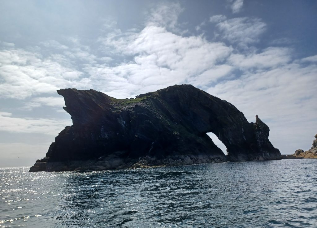
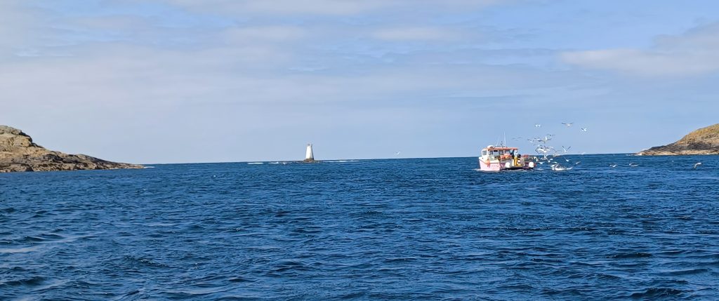
The boat potters round for a bit near the rocky foreshore and we survey the seals. A fishing boat heads between the island and the mainland in the choppier waters of the Sound. Screeching gulls follow in its wake. On the mainland across the sound from the island, a café is spied. Splendid position. Make a note to frequent it. Meanwhile, overhead, a spitfire passes, accompanied by the distinctive sound of its Merlin engine. It is taking a well-heeled tourist for a trip from the mainland. Costs about £4000 a go, we are told. Shadowed by a mustang, which our guide jokes, costs a bit less.
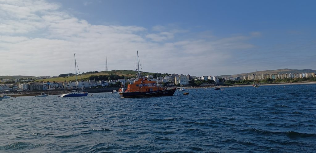
Time now to head back to port. The skipper takes the boat further from the coast, and heads speedily toward the harbour. Pastel coloured houses sit low on the cliffs in the sunlight and a lifeboat bobs in the sheltered waters.
Mull Circle Prehistoric Burial Site
It’s thirsty work boating. Thus we aim for that enticing café on the end of the mainland, observed from the boat. Drive along narrow roads lined with gorse bushes. Great view from here over to the Calf of Man. The wind gusts around the outside seating, so we go inside the café and find a sunny table with a splendid view from the big window. Order cream teas. Massive scones. Big enough for giants.
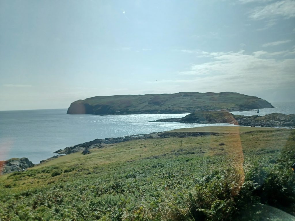
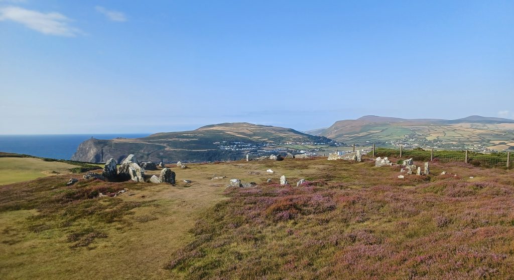
There is an archaeological site here on a flat hilltop on the edge of the mainland, worth looking at. Actually, it is a stone circle: the Mull Circle, a prehistoric burial site. It consists of six pairs of stone cists. Stunning scenery. Those prehistoric people from the Bronze Age, 3000 years BC, had an eye for a view. Must have been a fair few rituals going on here amongst the soft grasses and low heather looking across to Bradda and Port Erin.
Tynwald Hill
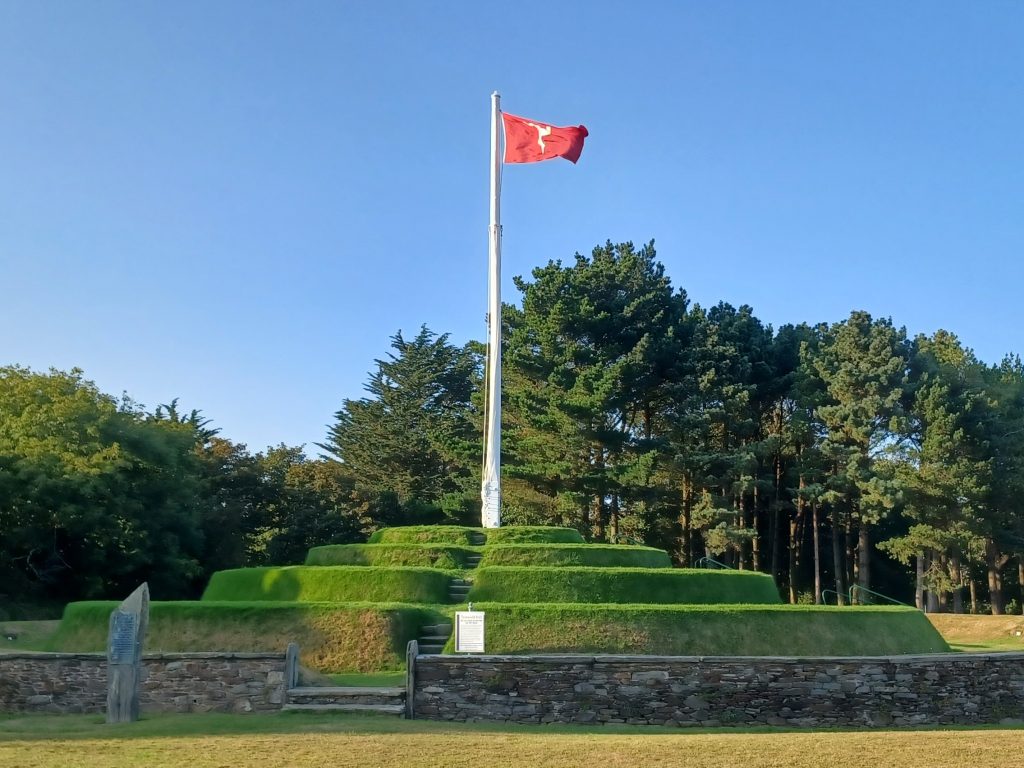
En route Peel-wards, we stop at the Tynwald assembly ground in St Johns, where the Manx Parliament meets on an annual basis to proclaim laws. Tynwald Hill dates back over one thousand years and the Manx believe that this national assembly is the oldest existing unbroken parliament anywhere, though Icelanders would argue that theirs is the oldest, which began in 930. The name ‘Tynwald’ is also taken from the Nordic, ‘Thingvollr’ (Icelandic: ‘Thingvellir’), meaning Parliament fields (see Iceland: The Golden Circle and Blue Lagoon). Anyway, here, atop the hill, on the old midsummer day, 5th July, sits the King’s representative, the Lieutenant Governor. In days gone by, the King would sit with his barons, judges and officers of state, while below were the Twenty Four Keys (the elected members of the House of Keys), along with clergy and squires, and outside the fenced enclosure were the ‘Commons of Man’.
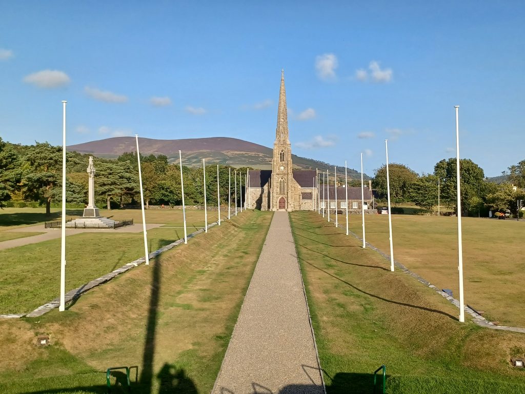
Opposite the hill is the Chapel of St John, dedicated to St John the Baptist, which serves as a court house and a church. The info tells us that this Hill, in the Manx language, is ‘Cronk Keeileion’, meaning the Hill of St John’s Chapel. And in between the two structures is a pebbly path leading to the War Memorial. Unveiled in 1923.
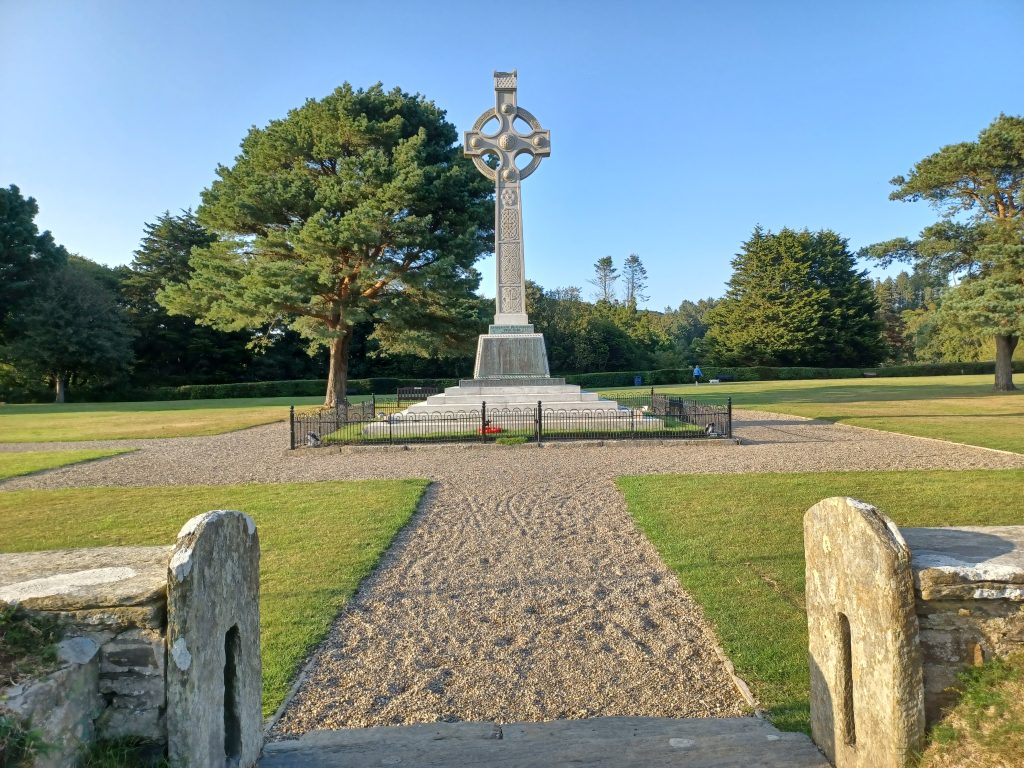
Walk up and down and around for a bit. Pleasant sort of place in the warm early evening sunlight.
Castle Rushen
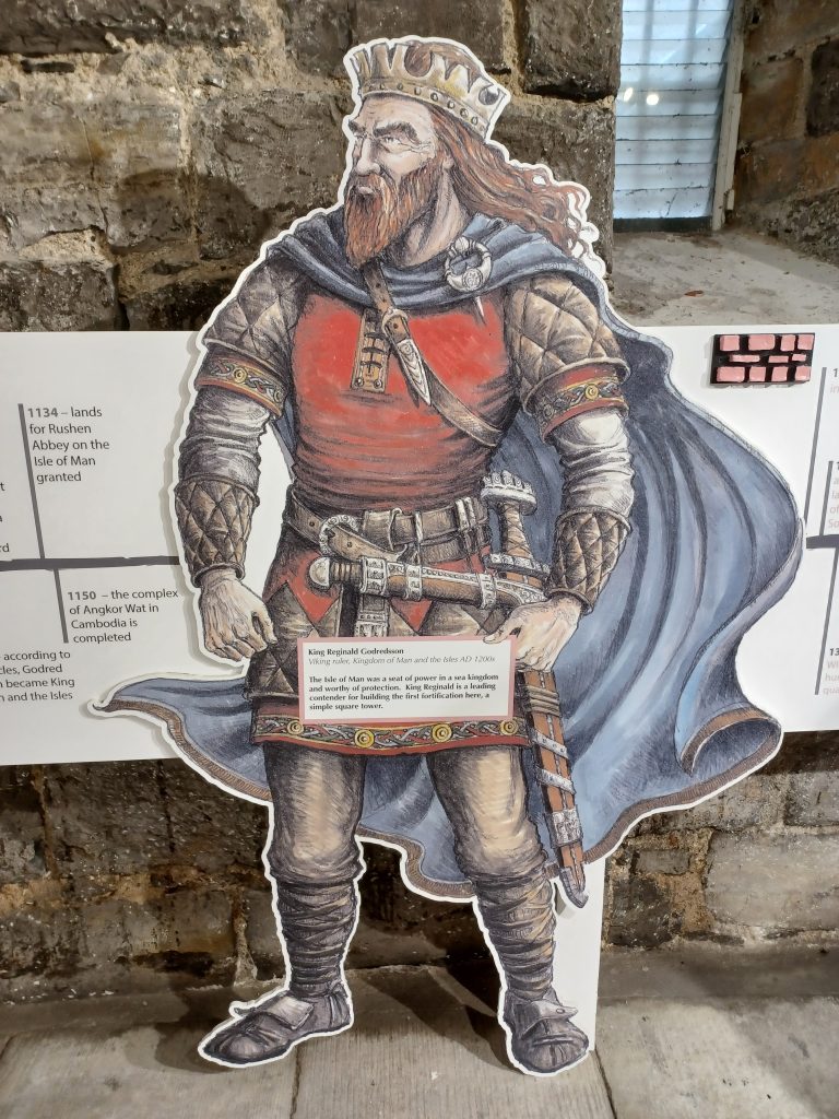
My last day this visit. Cloudyish, drizzle. On the agenda is a visit to the medieval Castle Rushen in Castletown. This castle was founded by the Vikings under King Reginald (Rögnvaldr). The last Norwegian King of Mann died here in 1265. The Castle was fought over many times subsequently by the English and Scots, captured by Robert the Bruce in 1313. Even the French captured it once ‒ in 1377. But the English eventually gained it.
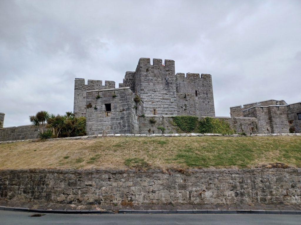
It was ruled over by the Stanley family from 1405 -1738, who were firstly Kings of Mann, before changing this title in 1521 to Lords of Mann. This title is still used by the British monarch. During its history, the castle has succumbed to various additions and alterations, such as those made by the Royalists and Parliamentarians during the Civil War, as well as by the Lords of Mann. And aside from being a fortification, it has performed diverse functions, such as a centre for the Government, a residence for the Kings and Lords of Mann, and a prison.
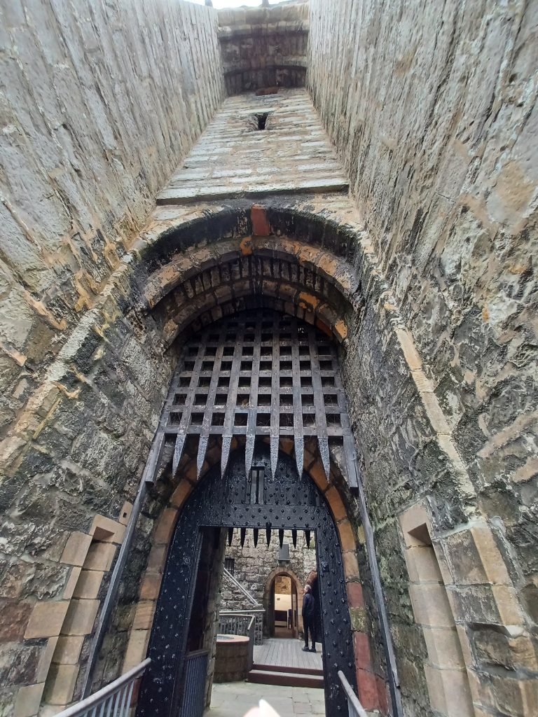
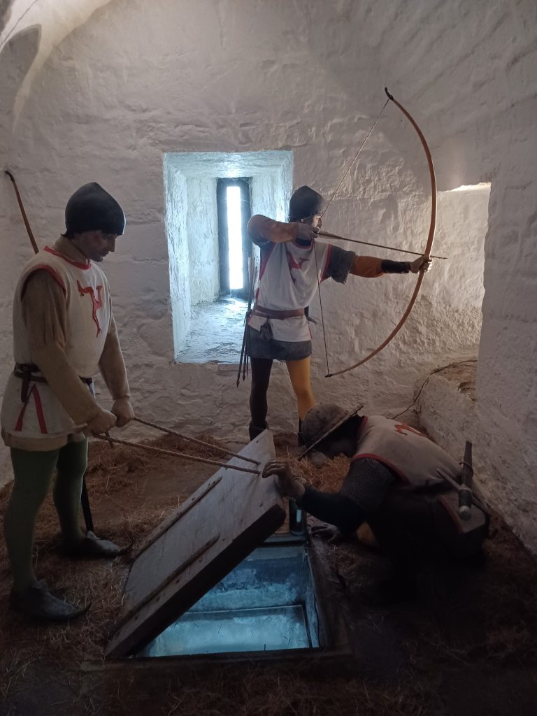
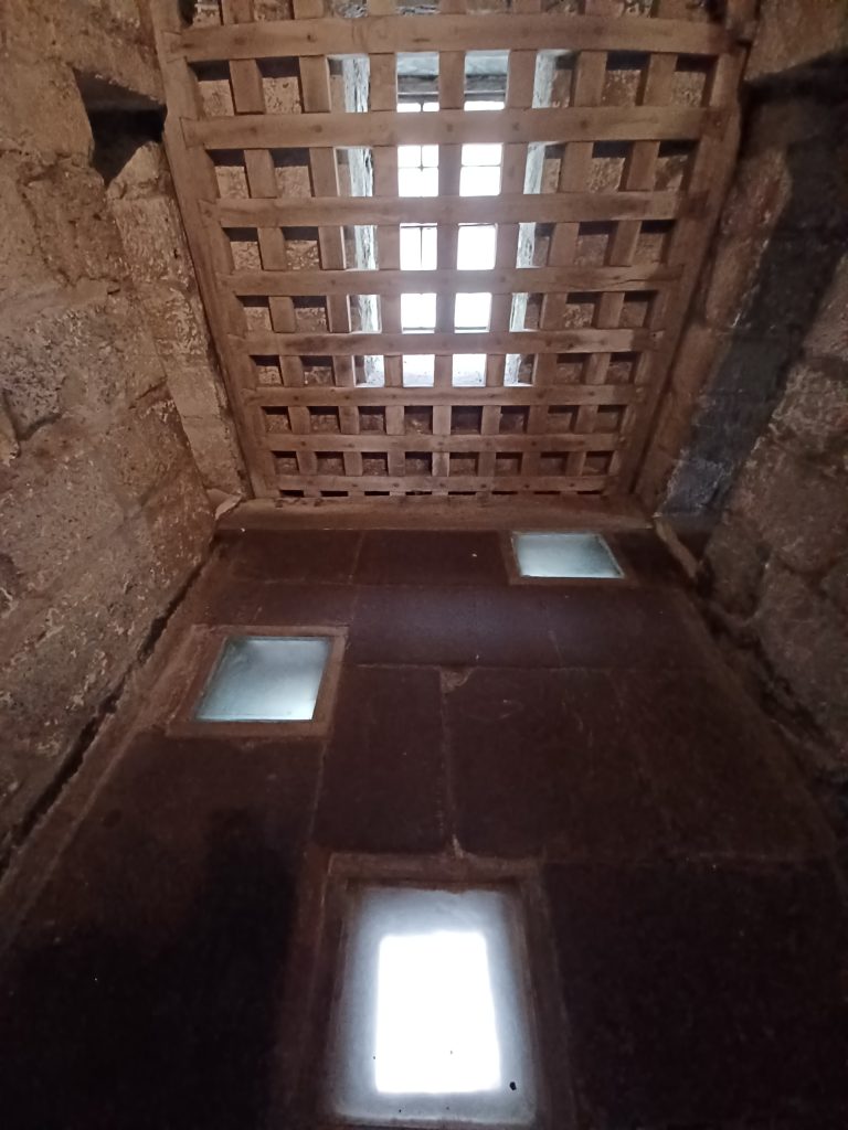
We cross the current bridge and enter beneath the first portcullis, glancing upwards to observe three murder holes above, which could be used for pouring boiling pitch on foes to finish them off. Also to pour water through in case of fire, one of the guides points out. Another portcullis beyond would trap the victims in the small space between them. Nice. From the large central stone keep, we ascend a stone spiral staircase into the room where sit the three murder holes and another room where archers are aiming their arrows through narrow slits.
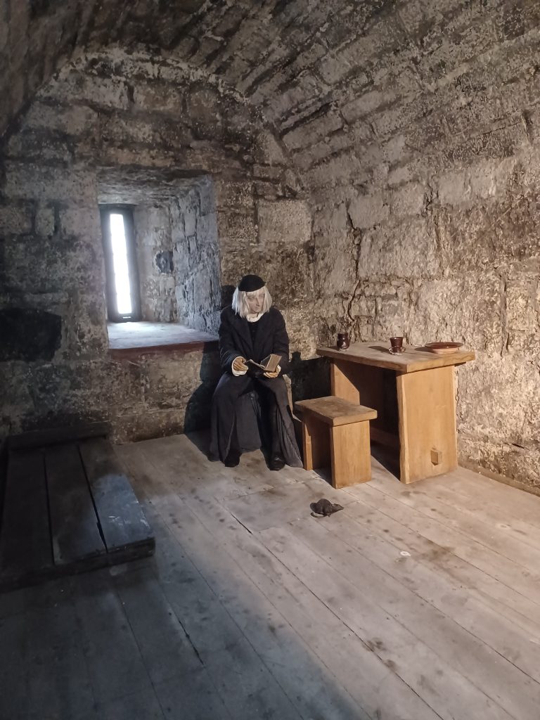
Wander into what were once the female prison cells. Not bad with their own private WC. The male cells were separated from the female ones. An Anglican Bishop of Sodor and Mann was one of the male inmates in the Castle in 1722, Thomas Wilson. He had had a contretemps with the then Lord of Mann, James Stanley. We see his modest stone cell. Amongst its many other notable functions, the castle was used for executions, and as an asylum for the insane. It gradually deteriorated and was handed over to Manx National Heritage for restoration in 1988.
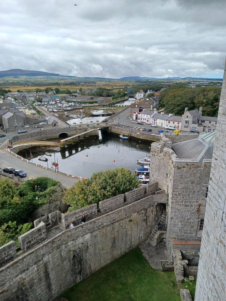
We climb the spiral staircases to the top of the castle where fabulous views await of the Drinking Dragon rock and the lighthouse, which we saw on our boat trip, and the Spanish cliffs where slabs of slate were quarried. Some of this slate was used for the floors in the castle, we learn. Interesting. Through the arrow slits we can also see Castletown’s small boat harbour and river, and a model of a very large grey heron. And the hills round about with Snaefell in the distance, recognisable by its two masts on top, the castle walls and the old cannon. Long drop into the keep below, as we peer tentatively downwards. There is a bell up here inscribed with ‘Earl of Derby,’ one of the Lords of Mann, and the date, 1729.
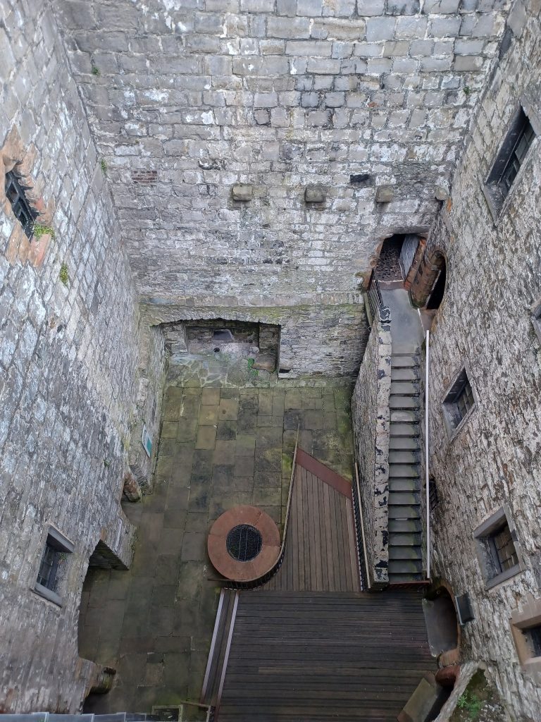
We descend via the once lavish rooms used by the Stanley family. The now bare walls of stone and floors of slate or wood would have been covered with tapestries when used by these Lords of Mann and their entourage. Not a bad place to be.
Visit over we hotfoot it to the nearest café for refreshments.
Thus ends my trip to the Isle of Man this time. A fascinating island, with a well preserved heritage, full of historical monuments with tantalising old legends, wild nature and unspoilt landscapes. A gem in the Irish Sea.
Leave a Reply